New York: State Flag, Capital and Regional Profile
The state of New York encompasses far more than the metropolis of the same name. Its capital is Albany, its landscape extends to the forests and lakes of the Adirondacks. The state flag shows a coat of arms on dark blue. Particularly vivid is the regional history on the Erie Canal, which connected Atlantic ports and the inland region.
Test your knowledge →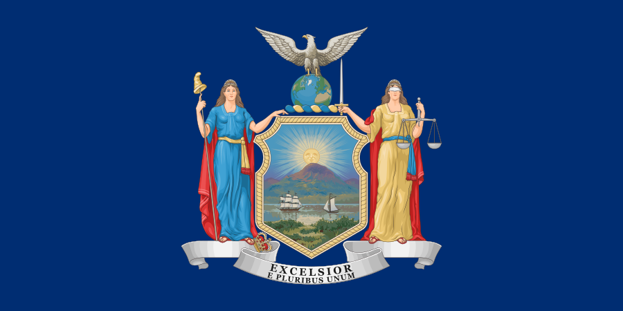
New York at a glance
- Name
- New York
- Country
- United States
- Profile type
- US state
- Administrative seat in source record
- Albany
- Erie Canal opens
- 1825
- Historical canal axis
- Buffalo–Albany
- Construction period of the original Erie Canal
- Eight years
- Other State Channels
- Champlain, Oswego and Cayuga-Seneca
- Adirondack Park
- Contains public and private land and places
- Adirondack sports resort
- Lake Placid with Olympic Center
- Management of state Adirondack plots
- New York State Department of Environmental Conservation
- Canoe Route in the Adirondacks
- From Old Forge towards Tupper Lake and Saranac Lakes
The Flag of New York
The state flag shown has a dark blue background with the state coat of arms in the middle. Two female figures flank a shield with water, ships, mountains and rising sun. Above it sits an eagle on a globe; below it lies the ribbon with the slogans Excelsior and E pluribus unum.
The characters stand for freedom and justice. Justice wears a blindfold, a sword and a scale; liberty wears a rod with a liberty hat. Under the sign are the two mottos Excelsior and E pluribus unum in two lines. The second motto added in 2020 is also included in the illustration shown here.
New York: Location and Territorial Role
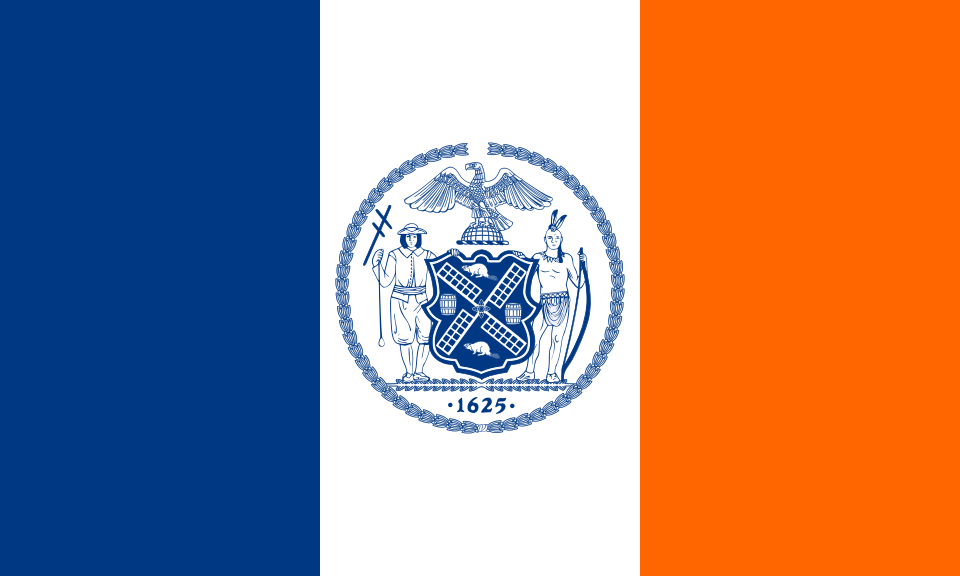
Albany is the political center of the state, New York City a city of its own within the same state. Their blue-white-orange city flag is another sign. This separation is also geographically important: The Adirondacks and the historic canal cities belong to New York State without being parts of the big city.
The Erie Canal was planned as a link between Buffalo and Albany. Thus, his transport area connected the Great Lakes with the way to the Atlantic. The history of this axis helps to understand why many cities inland along a common trade route were formed or decisively shaped by it.
Landscape, History and Culture
The Erie Canal, opened in 1825, was a major transport project of the early industrial age. Eight years of construction preceded its opening. During the symbolic connection of the waters, water from Lake Erie was poured into the Atlantic Ocean. This ritual made the economic connection between coast and inland publicly visible.
Adirondack Park is not a completely deserted area. Within its borders are public forests and private land, but also places, agriculture, mountains, lakes and rivers. It is precisely this juxtaposition that distinguishes him from the popular idea of a park consisting exclusively of state-administered wilderness.
The canal network continued to develop after the first opening. Other waterways include the Champlain, Oswego and Cayuga-Seneca Canals. Expansions and new locks adapted the infrastructure of changed ships. Today, the canals also convey traffic history and opportunities for recreation on the water.
Adirondacks as a Cultural Landscape
The state park administration describes the Adirondacks as a link of vast forests, mountains, valleys and populated areas. Ancient forests stand next to places and farmland. Looking at this mix prevents conservation and human use from being misunderstood as completely separate worlds.
Erie Canal and cities
The canal should make trade between coastal ports and western inland areas safer and more reliable. Its opening fundamentally changed the development of the state. The later merger of several waterways into the New York State Canal System shows that a single connection became an entire transport network.
Justice in the Coat of Arms
The blindfold and scale of the right crest figure declare the claim of impartial jurisdiction. The left figure embodies freedom and stands next to a discarded crown. These details provide more orientation when recognizing than the background color alone, which many other US state flags use.
Explore this country and nearby profiles
 United States
 New York City
 Chicago
 Washington, D.C.
 Los Angeles
 San Francisco
 California
What did you discover?
Take this flag into the quiz
Sources and image credits
This English article draws on the institutional sources listed below. Figures and memberships retain their stated reference dates.
Source record: 2 November 2026. A translation does not change the reference date of a figure or membership list.
- dos.ny.gov/new-york-state-emblems
- canals.ny.gov/About/History
- parks.ny.gov/visit/regions/adirondacks
- nysm.nysed.gov/research-collections/history/economic-history/news/transporting-grains-erie-canal
- nysenate.gov/legislation/laws/STL/70