Baden-Württemberg: State Flag, Capital and Regional Profile
Baden-Württemberg is located in the southwest of Germany and connects the Upper Rhine with the Black Forest, Swabian Alb and Lake Constance. Its black-and-golden national flag is strikingly simple. The present federal state was only created in 1952 from three post-war countries; its landscapes and historical parts of the country, however, have much older traditions, which are visible together in the detailed coat of arms.
Test your knowledge →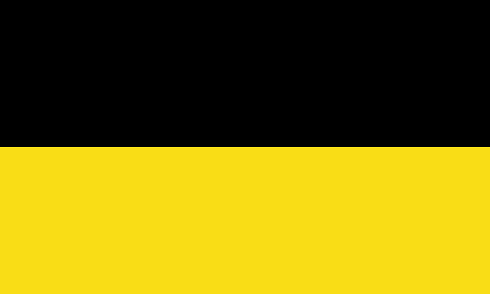
Baden-Württemberg at a glance
- Name
- Baden-Württemberg
- Country
- Germany
- Profile type
- German federal state
- Administrative seat in source record
- Stuttgart
- Establishment
- 25 April 1952
- Predecessor countries
- Baden, Württemberg-Baden and Württemberg-Hohenzollern
- Western River
- Rhine
- Further main river
- Neckar
- Highest survey
- Feldberg, 1493 meters
- Danube Creation
- Confluence of Brigach and Breg at Donaueschingen
- Eastern landscape
- Swabian albs
- Northern Landscape
- Hohenlør level
- Coat of arms decision
- 1954
The Flag of Baden-Württemberg
The country flag shown here consists of two horizontal tracks: above black, below gold. A coat of arms is not placed on this holder. For the recognition, order and uniformity of the surfaces are important. Representations with country coats of arms are additional official variants and must not be confused with the simple cloth shown here.
The state constitution initially determined the colors black and gold, while the agreement on the coat of arms was only later. The coat of arms adopted in 1954 picks up three black lions in a golden shield. The flag itself does not show these figures, but uses the same basic colors and thus combines a simple color sign with the heraldic tradition.
Baden-Württemberg: Location and Territorial Role
Baden-Württemberg borders France in the west and Switzerland in the south; it is also located on Lake Constance in the European border area. Within Germany, Rhineland-Palatinate, Hesse and Bavaria are neighbours. The location on the Rhine and Danube at the same time creates connections in different directions in Europe and helps to understand the southwest as a transport and exchange area.
Stuttgart is the state capital. This means that the central political institutions of the federal state have their seat here; the state capital is not to be equated with the entire state. Other important cities are located in very different landscape areas, such as Mannheim on the Rhine, Karlsruhe near the Rhine Plain and Freiburg on the western edge of the Black Forest.
Landscape, History and Culture
The Black Forest and the Rhine Plain characterize the west, while the Swabian Alb further east forms a different landscape. In the north, Kraichgau and Hohenloher Plain are added. These differences explain why Baden-Württemberg is neither exclusively a mountainous country nor alone a densely built industrial region. Agriculture, forests, valleys and cities form a diverse coexistence.
On 25 April 1952, Baden, Württemberg-Baden and Württemberg-Hohenzollern were united into the new federal state. The merger followed a controversial political debate and a referendum. The current common name must therefore not hide the fact that different countries and identities have been brought together in a new democratic order.
The large coat of arms makes this diversity particularly clear. In addition to the shield with the three lions, it contains historical signs of several territories. Hirsch and Greif are reminiscent of Württemberg and Baden. The small coat of arms dispenses with these sign holders. When learning flags, the separation between coat-of-arm shapes and the simple black-and-golden flag is helpful.
Feldberg
The Feldberg in the southern Black Forest is with 1493 meters the highest elevation in the country. The altitude is very different from the deep Rhine areas in the west. This comparison alone explains part of the landscape diversity and shows why distances on the map alone say little about terrain and surroundings.
Danube near Donaueschingen
At Donaueschingen, Brigach and Breg unite to form the Danube. The river then crosses the southern part of the country and reaches Bavaria near Ulm. This starts a connection to southeastern Europe, while the Rhine water leads to the north. Both river systems give the country a supraregional geographical significance.
Constance sea basin
Lake Constance forms an important southern landscape area. Its shores connect cities, cultural landscape and the view of the Alpine region. But Baden-Württemberg does not own the entire lake: Bavaria, Austria and Switzerland are also part of its environment. The lake thus simultaneously explains regional characteristics and cross-border relations.
Explore this country and nearby profiles
 Germany
 Munich
 Cologne
 Frankfurt am Main
 Stuttgart
 Düsseldorf
 Dresden
What did you discover?
Take this flag into the quiz
Sources and image credits
This English article draws on the institutional sources listed below. Figures and memberships retain their stated reference dates.
Source record: 2 November 2026. A translation does not change the reference date of a figure or membership list.
- baden-wuerttemberg.de/de/unser-land/land-und-leute/geografie
- baden-wuerttemberg.de/de/unser-land/geschichte/entstehung-des-suedweststaats
- baden-wuerttemberg.de/de/unser-land/landeswappen-und-hymnen/landeswappen/
- la-bw.de/de/themen/praesentationen---themenzugaenge/72291
- lpb-bw.de/publikationen/politischelandeskunde/raum_grenzen.pdf
- donaueschingen.de/donauursprung