Lebanon Flag, Capital and Country Facts
Lebanon is located on the eastern Mediterranean coast and, despite its small area, has pronounced differences in altitude. Beirut is the capital and port city, while mountains and the Bekaa plain form their own landscape spaces. The green cedar on the red-and-white flag is a particularly clear mark of recognition and at the same time associated with the natural and cultural history of the country.
Test your knowledge →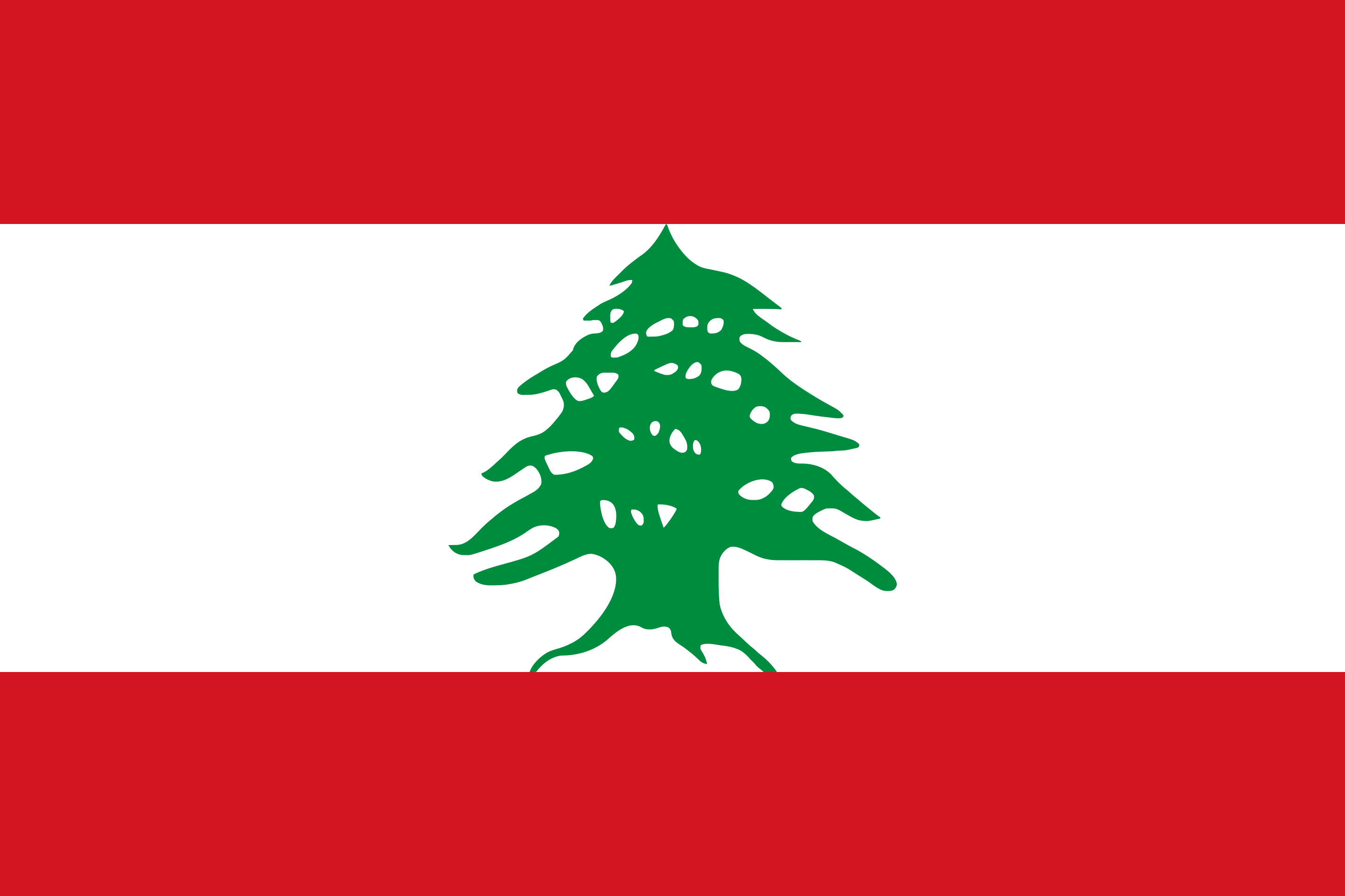
Lebanon at a glance
- Capital
- Beirut
- Quiz continent
- Asia
- Languages in reference record
- Arabic (official language); also spreads French and English
- Currency
- Lebanese pound (LBP)
- Population
- 5,849,421 (2025, World Bank)
- Area
- 10,452 km²
- Coastal setting
- Not landlocked
- ISO codes
- LB / LBN
- Internet country suffix
- .lb
- Highest point
- Qornet es Saouda, 3,088 m
- National holiday
- 22 November
- Central inland level
- Bekaa
- Flag tree
- Cedar
- Western maritime area
- Mediterranean Sea
- Mountains of Syria
- antilibanone
Lebanon Flag: Design, Meaning and History
Two red border stripes enclose a white middle strip twice as high. In the middle of it stands a green cedar. The tree is the decisive distinguishing feature: the flag has neither star nor crescent. The white and red areas alone, on the other hand, would not clearly distinguish them from other national flags.
The Factbook archive combines red with the liberation struggle and white with peace, purity and the snow of the mountains. The cedar is a national symbol and is associated with durability and permanence. This tree species has a concrete reference to the landscape; the motif therefore does not have to be explained by a freely invented meaning of each individual branch.
Capital: Beirut
Beirut is located on a coastal outcrop on the Mediterranean Sea. The capital has an important port and is an important centre of trade, education and culture. Its maritime location connects it with the historical coastal cities of the eastern Mediterranean world, while the mountains only separate a relatively narrow coastal area from the interior.
The city name is associated with an old word for fountain. Beirut’s history spans many eras, but today’s city must not be equated with a single one. The neighbouring mountain areas and the traffic routes through them also explain why the capital is closely connected with very different regions of the small country.
Practise this capital →Lebanon: Geography, History and Culture
From the Mediterranean Sea, the terrain rises steeply to the Lebanon mountains. East of this lies the Bekaa Plain, further east the Anti-Lebanon Mountains on the border with Syria. The highest point of Qornet es Saouda reaches 3,088 meters. Snow in the mountains and warm coastal conditions can therefore occur spatially close together; small does not mean uniform landscapes here.
Arabic is an official language; French and English are also common. The linguistic links reflect trade, education and different historical influences. Religiously, the country also has a diverse history. A representation as the home of only one community would miss this connection. The long coastal history includes Phoenician cities, while other monuments document Roman or later eras.
Lebanon declared its independence in 1943 in connection with the end of the French Mandate Order. The national holiday is on 22 November. Historic coastal towns, temple complexes and mountain landscapes are part of the UNESCO heritage. For a country profile, the distinction between enduring geographical and cultural characteristics and a rapidly changing political or economic situation is particularly important.
Baalbek
Baalbek has been a UNESCO World Heritage Site since 1984. The site is one of the important ancient monuments of the country and is located in the interior of the Bekaa. It complements the often dominant image of Lebanon as a narrow coastal state with a historical landscape inland.
Cedars and Qadisha
The Qadisha valley and the forest of the Lord’s cedars form a joint World Heritage entry from 1998. Landscape, religious history and the national tree symbol are tangibly linked here. The cedar on the flag thus has a visible reference to a real protected landscape.
Byblos and Tyros
Both coastal cities have been World Heritage sites since 1984. They point to the historical importance of the Eastern Mediterranean for trade and cultural contacts. Together with Beirut, they show that the coastal history is spread over several centers.
Explore neighbouring and related places
 Israel
 Syria
What did you discover?
Sources and image credits
This English article draws on the institutional sources listed below. Figures and memberships retain their stated reference dates.
Source record: 2 November 2026. A translation does not change the reference date of a figure or membership list.
- github.com/factbook/factbook.json/blob/144d6977b2b01ac1cbd220de754c0a005616760b/middle-east/le.json
- data.worldbank.org/indicator/SP.POP.TOTL
- whc.unesco.org/en/statesparties/lb
- github.com/mledoze/countries