Guinea Flag, Capital and Country Facts
Guinea lies on the West African Atlantic coast and must not be confused with Guinea-Bissau or Equatorial Guinea. Behind the coastal plain are highlands, savannahs and forested mountain regions. The flag carries pan-African colors in vertical stripes. Conakry combines the role of the capital with a spatial location strongly determined by the sea.
Test your knowledge →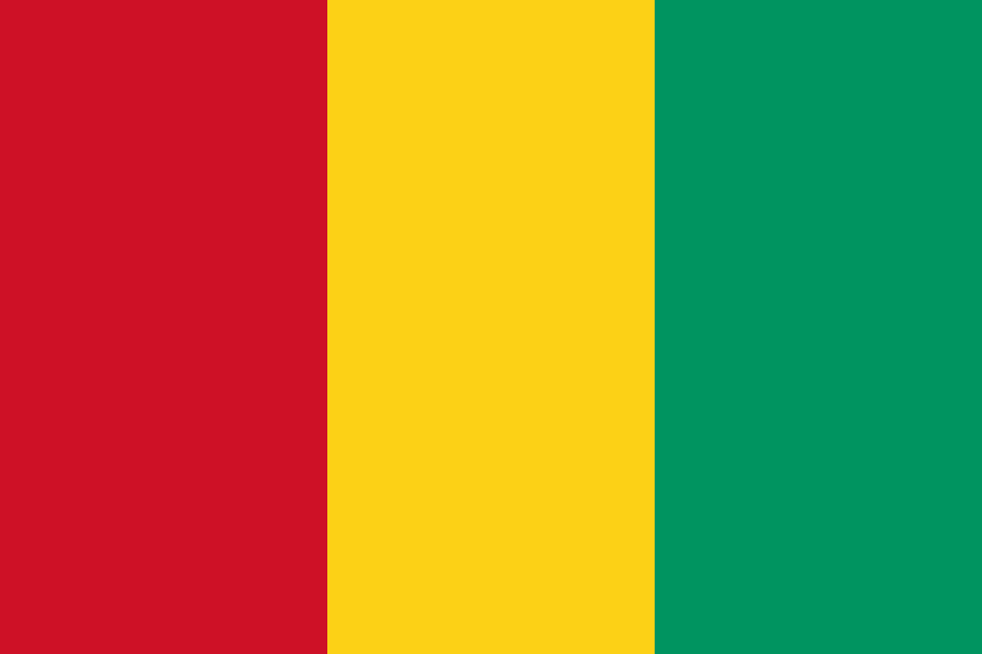
Guinea at a glance
- Capital
- Conakry
- Quiz continent
- Africa
- Languages in reference record
- French; other widely spoken languages including Pular, Maninka and Susu
- Currency
- Guinea-Franc (GNF)
- Population
- 15,099,727 (2025, World Bank)
- Area
- 245,857 km²
- Coastal setting
- Not landlocked
- ISO codes
- GN / GIN
- Internet country suffix
- .gn
- Highest mountain
- Mont Nimba, 1,752 m
- Independence
- 2 October 1958
- Important highlands
- Fouta Djallon
- Important raw material
- bauxite
- Port capital
- Conakry
- Cross-border natural heritage
- Mont Nimba with Côte d’Ivoire
Guinea Flag: Design, Meaning and History
The flag shows three equally wide vertical stripes: red on the pole side, then yellow and green on the outside. It has no star and no coat of arms. A particularly useful comparison is Mali: there the order is green, yellow, red. When assigning, therefore, not only the color set counts, but its direction.
Red, yellow and green are part of the Pan-African color tradition. In Guinea’s national interpretation, they stand, among other things, for the victims of liberation, sun and mineral resources as well as vegetation and unity. The flag was adopted in the year of independence in 1958. The symbolism combines political independence with the natural foundations of the country.
Capital: Conakry
Conakry is located on the Atlantic coast on a long peninsula and in adjacent urban areas. This form limits the space for traffic routes and settlements. As a capital, port and economic centre, the city fulfils several tasks at the same time. Its sea location clearly distinguishes it from the higher inland regions.
The development of the port reinforced Conakry’s role as an access to the world market. Political institutions and the movement of goods are thus concentrated in the coastal area. However, the highlands of Fouta Djallon and the forest region in the southeast have other landscapes and settlement histories. The capital is an important starting point, but not a spatial summary of the whole of Guinea.
Practise this capital →Guinea: Geography, History and Culture
Guinea is often divided into four large natural areas: Coastal Guinea, the Middle Highlands, Upper Guinea and Forest Guinea. In Fouta Djallon, important West African rivers and their source rivers originate. This also makes the highlands important for neighbouring countries that operate with this water far outside Guinea. Niger originates in Guinea, but initially flows far into the West African landlocked country. Its long arc shows that a nearby Atlantic coastline does not automatically determine the direction in which a river drains.
French is the official language, while Pular, Maninka, Susu and other languages shape everyday life. The regionally different distribution is related to trade routes and settlement history. A state with a common administrative language can therefore simultaneously contain several large African linguistic areas. The flag marks state unity, not linguistic uniformity.
The factbook archive stand of 2025 describes Guinea as a major bauxite producer. Bauxite serves as a feedstock for aluminium, but mining and processing are not necessarily in the same location. Compared to this raw material economy, there is the importance of watersheds and species-rich highlands. On Mont Nimba, both natural areas and conservation tasks cross the national borders.
Mont Nimba
The strict nature reserve Mont Nimba is a UNESCO World Heritage Site and is shared with Côte d’Ivoire. Protection concerns a continuous mountain range and not just an isolated summit.
Source regions
Guinea’s highlands are important for several West African river systems. As a result, a coastal state is also of particular importance for distant inland regions.
Autonomous State Name
Guinea, Guinea-Bissau and Equatorial Guinea are three different states. The distinction according to capital and location prevents frequent confusion in the country quiz.
Explore neighbouring and related places
 Côte d’Ivoire
 Guinea-Bissau
 Liberia
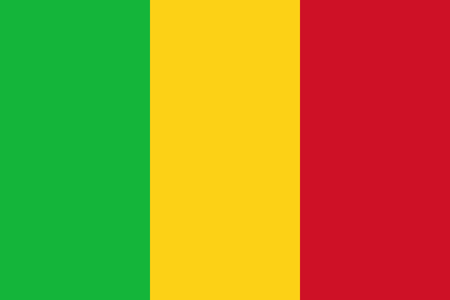 Mali
 Senegal
 Sierra Leone
What did you discover?
Sources and image credits
This English article draws on the institutional sources listed below. Figures and memberships retain their stated reference dates.
Source record: 2 November 2026. A translation does not change the reference date of a figure or membership list.
- github.com/factbook/factbook.json/blob/144d6977b2b01ac1cbd220de754c0a005616760b/africa/gv.json
- data.worldbank.org/indicator/SP.POP.TOTL
- whc.unesco.org/en/statesparties/gn
- github.com/mledoze/countries