Democratic Republic of the Congo Flag, Capital and Country Facts
The Democratic Republic of Congo covers a large part of the Central African Congo basin. Rainforests, a vast river system and the high mountains of the east belong to the same state. Its flag can be recognized by the red, yellow-lined oblique beam. The country name must be distinguished from the neighboring Republic of Congo with the capital Brazzaville.
Test your knowledge →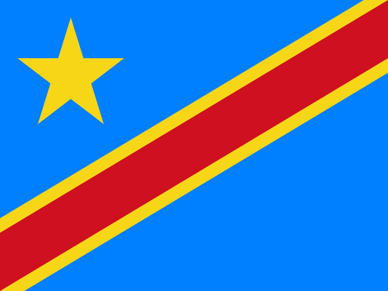
Democratic Republic of the Congo at a glance
- Capital
- Kinshasa
- Quiz continent
- Africa
- Languages in reference record
- French; national languages including Lingala, Kikongo, Kiswahili and Tshiluba
- Currency
- Congo franc (CDF)
- Population
- 112,832,473 (2025, World Bank)
- Area
- 2,344,858 km²
- Coastal setting
- Not landlocked
- ISO codes
- CD / COD
- Internet country suffix
- .cd
- Independence
- 30 June 1960
- Former State name
- Zaire, 1971–1997
- Border river of the capital
- Congo
- Opposite capital
- Brazzaville
- Mountains in the east
- Ruwenzori
- National forest animal
- Okapi
Democratic Republic of the Congo Flag: Design, Meaning and History
A sky blue field is traversed by a red stripe from the bottom left to the top right. Narrow yellow hems accompany him. On the top left is a single yellow five-pointed star. The combination of star and ascending oblique beam is the most important distinguishing mark; it is not the horizontal tricolor of the former Zaire.
In the archived factbook, blue is associated with peace and hope, red with the victims of historical struggles and yellow with wealth. The star stands for unity and future. This symbolic language belongs to the state self-image. It does not describe a conflict-free reality, because the east of the country in particular has had serious experiences of violence.
Capital: Kinshasa
Kinshasa is located on the Congo opposite Brazzaville. Between the two capitals, the river runs at the same time as a state border. The unusual opposite of two metropolises explains why the addition Kinshasa or Brazzaville is often used to unambiguously naming the two Congo states. The names are not interchangeable writing variants.
The city was called Léopoldville in the colonial period and received the name Kinshasa in 1966. Its location on the river linked trade, administration and transport. Downstream, however, rapids prevent continuous shipping to the Atlantic Ocean. Therefore, a large river does not automatically mean that each section works as a simple waterway.
Practise this capital →Democratic Republic of the Congo: Geography, History and Culture
The Congo Basin is one of the most important tropical forest areas on earth. In the center are extensive lowlands; in the east, the terrain rises to the East African Trench and the Ruwenzori Mountains. These contrasts explain why rainforest animals and high mountain landscapes occur in descriptions of the same country. The state also has a short Atlantic access in the west. Its vast land area is therefore predominantly in the interior of Africa, but it is not a landlocked country. There are different traffic conditions between the coast and the capital than between the numerous river ports of the central basin.
French serves as an official language, in addition, several national languages of communication have great importance. The enormous territory makes linguistic and regional diversity a basic condition of everyday life. Kinshasa’s Lingala-shaped environment is therefore not a complete image of the East, where Kiswahili plays an important role.
The history includes the Kingdom of Congo, colonial rule under Leopold II and Belgium, as well as the independence of 1960. The factbook archive stand of 2025 mentions important mineral raw materials. However, resources of raw materials, economic benefits for the population and protection of forests are different issues; no general prosperity can be derived from mineral resources alone.
Virunga
The Virunga National Park is a UNESCO World Heritage Site. Its eastern location shows that the state includes mountain and volcanic landscapes in addition to the central forest basin.
Okapi Protected Area
The Okapi Wildlife Reserve is also a World Heritage Site. The Okapi is a characteristic forest animal and illustrates the independent wildlife of the Central African rainforests.
Salonga’
The Salonga National Park is another UNESCO entry. Together with Garamba and Kahuzi-Biega, he shows the diversity of protected habitats of the country.
Explore neighbouring and related places
 Angola
 Burundi
 Central African Republic
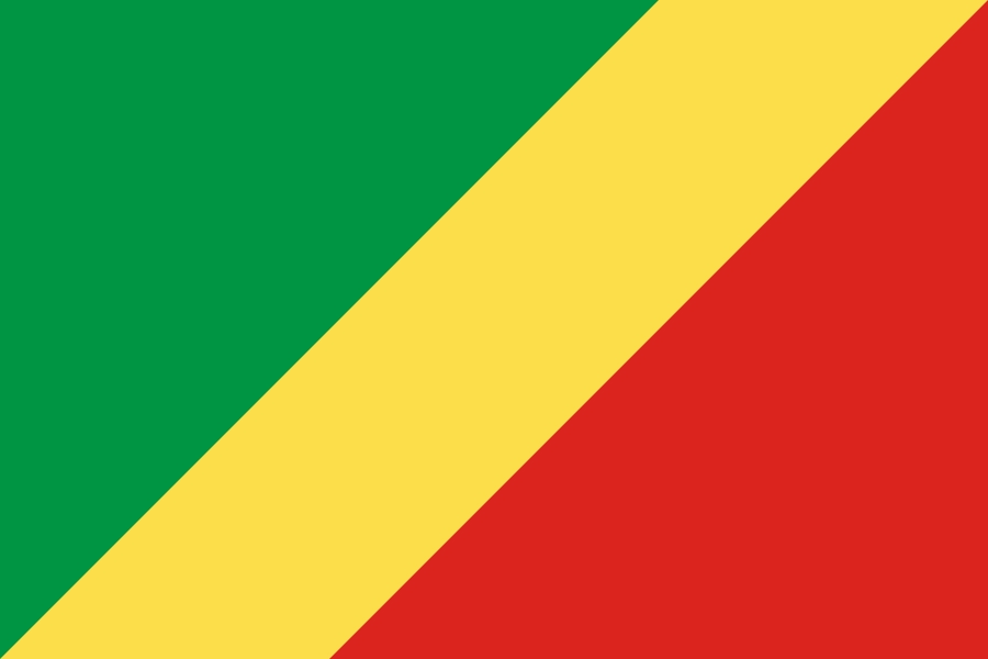 Republic of the Congo
 Rwanda
 South Sudan
What did you discover?
Sources and image credits
This English article draws on the institutional sources listed below. Figures and memberships retain their stated reference dates.
Source record: 2 November 2026. A translation does not change the reference date of a figure or membership list.
- github.com/factbook/factbook.json/blob/144d6977b2b01ac1cbd220de754c0a005616760b/africa/cg.json
- data.worldbank.org/indicator/SP.POP.TOTL
- whc.unesco.org/en/statesparties/cd
- github.com/mledoze/countries