Republic of the Congo Flag, Capital and Country Facts
The Republic of Congo is located in western Central Africa on the Atlantic Ocean and in the catchment area of the Congo River. It is often called Congo-Brazzaville for distinction from the larger neighboring state. Rainforests, river landscapes and the capital on the opposite bank of Kinshasa help to distinguish the two similarly named states on the map.
Test your knowledge →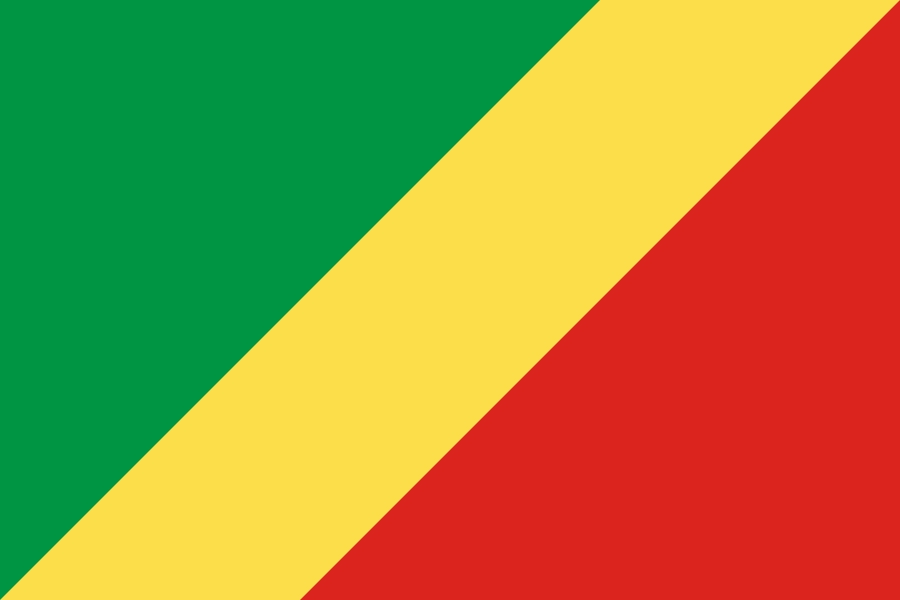
Republic of the Congo at a glance
- Capital
- Brazzaville
- Quiz continent
- Africa
- Languages in reference record
- French (official language); Lingala, Kituba and other languages
- Currency
- Central African CFA franc (XAF)
- Population
- 6,484,437 (2025, World Bank)
- Area
- 342,000 km²
- Coastal setting
- Not landlocked
- ISO codes
- CG / COG
- Internet country suffix
- .cg
- Independence
- 15 August 1960 by France
- Large river
- Congo
- Seaport
- Pointe-Noire
- Neighboring capital
- Kinshasa on the opposite shore
- Natural World Heritage
- Odzala-Kokoua, since 2023
- Cross-border World Heritage
- Sangha Trinational, since 2012
Republic of the Congo Flag: Design, Meaning and History
A wide yellow slant pulls from the bottom left to the top right. Above it lies a green triangle on the hoist side, below it a red one on the right. The flag is therefore not a horizontal tricolor. It bears neither a star nor a coat of arms and is clearly different from the blue flag of the Democratic Republic of Congo.
The colors belong to the Pan-African tradition. The Factbook archive explains green with agriculture and forests, yellow with friendship and human virtues. There are different interpretations for red; a single officially defined meaning cannot be derived from this. In learning, therefore, the diagonal arrangement offers the more reliable clue.
Capital: Brazzaville
Brazzaville is located on the Congo River, directly opposite Kinshasa in the Democratic Republic of the Congo. Both are capitals of independent states. The common river and the proximity make the danger of confusion understandable, at the same time the two city names offer the easiest way to clearly distinguish.
The name Brazzaville is reminiscent of Pierre Savorgnan de Brazza and thus of French colonial history. The capital is located in the southern part of the country, not on the Atlantic coast. The important seaport of Pointe-Noire assumes a different spatial function: it connects the land with the sea, while Brazzaville is oriented towards the power room.
Practise this capital →Republic of the Congo: Geography, History and Culture
The country connects a narrow Atlantic coastline with hillside landscapes, plateaus and extensive forest areas inside. In the north, large areas belong to the Congo Basin. The warm climate is characterized by rainy and dry seasons. Watercourses are both habitats and traffic axes; therefore, the landscape cannot be meaningfully described as a rainforest that is uniform everywhere.
French is an official language, Lingala and Kituba are important interregional languages of communication. Many other languages reflect regional communities. The river name Congo refers to a historical and geographical area that goes far beyond the borders of this state. The fact that two neighbouring states bear the same name is therefore not a coincidence, but an expression of a common regional history.
The Republic of Congo became independent from France on 15 August 1960. Their neighbor on the other bank of the river has a different colonial history and a much larger area. Petroleum is one of the economic fundamentals described in the Factbook archive. The protected areas in the north also show the international importance of forests, whose ecosystems cross national borders.
Odzala-Kokoua
The forest massif of Odzala-Kokoua was registered as a UNESCO natural heritage site in 2023. It stands for the forests of the Congo basin. This means that the country has an internationally recognized natural site, which is far from the political centre of Brazzaville.
Sangha Trinational
This World Heritage site crosses borders with Cameroon and the Central African Republic. The entry is from 2012. Its name already makes it clear that nature conservation is thought of here in a contiguous forest area across national borders.
Two Congos
Brazzaville and Kinshasa face each other on the same stream. Nevertheless, they belong to different states with different flags. For a country quiz, the combination of name, capital and flag form is especially helpful in keeping the two safely apart.
Explore neighbouring and related places
 Angola
 Cameroon
 Central African Republic
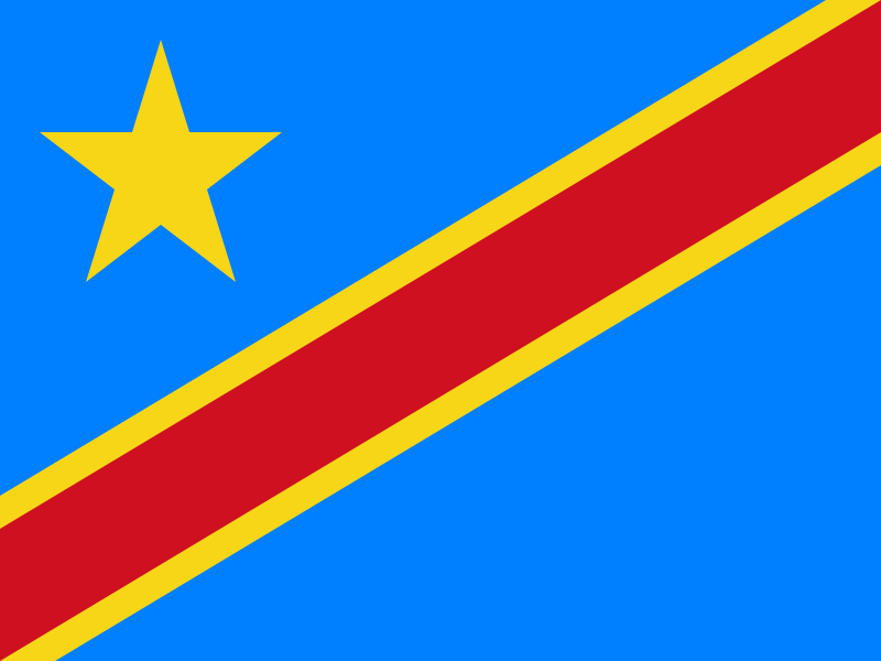 Democratic Republic of the Congo
 Gabon
What did you discover?
Sources and image credits
This English article draws on the institutional sources listed below. Figures and memberships retain their stated reference dates.
Source record: 2 November 2026. A translation does not change the reference date of a figure or membership list.
- github.com/factbook/factbook.json/blob/144d6977b2b01ac1cbd220de754c0a005616760b/africa/cf.json
- data.worldbank.org/indicator/SP.POP.TOTL
- whc.unesco.org/en/statesparties/cg
- github.com/mledoze/countries