Czechia Flag, Capital and Country Facts
As a landlocked country, the Czech Republic lies in the heart of Europe and includes the historical landscapes of Bohemia, Moravia and part of Silesia. River basins and rims give the country its shape. The capital Prague is located on the Moldova. On the flag, a blue wedge complements the two horizontal stripes in white and red.
Test your knowledge →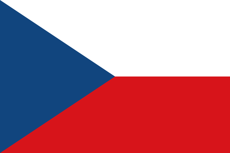
Czechia at a glance
- Capital
- Prague
- Quiz continent
- Europe
- Languages in reference record
- Czech
- Currency
- Czech koruna (CZK)
- Population
- 10,886,878 (2025, World Bank)
- Area
- 78,865 km²
- Coastal setting
- Landlocked
- ISO codes
- CZ / CZE
- Internet country suffix
- .cz
- Highest mountain
- Schneekoppe / Sněžka, 1.603 m
- River through Prague
- Moldova/Vltava
- Historical parts
- Bohemia, Moravia and Czech Silesia
- State autonomy
- Since 1 January 1993
- Moravian Centre
- Brno/Brno
- Important transport area
- Moravian gate
Czechia Flag: Design, Meaning and History
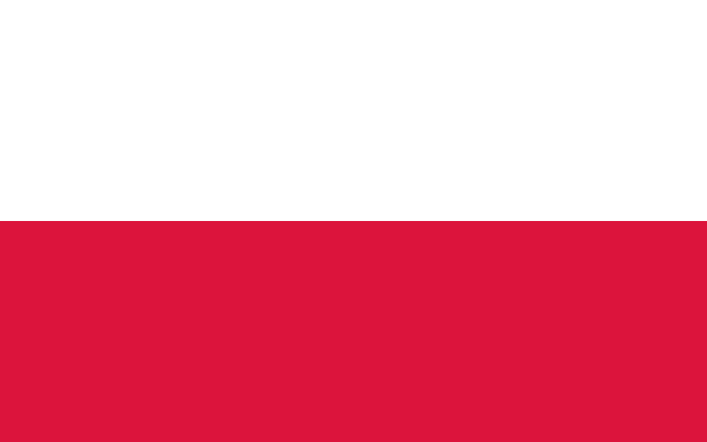
At the top, the flag is white, at the bottom red. From the left edge, a blue isosceles triangle protrudes to the center. This triangle is the sure reference to the Czech Republic: a mere white-red two-colouredness would remind of Poland. The Czech flag does not need a coat of arms, because its geometric shape already provides an independent identification mark.
The motif was already used by Czechoslovakia and remained the flag of the Czech Republic after its dissolution in 1993. White and red are in the heraldic tradition of Bohemia; blue complements the older two-colouredness. The common past explains why historical images of the same motif do not always denote the same state and the same territorial extent.
Capital: Prague
Prague is located in the Bohemian part of the country on the Moldova, which flows further north into the Elbe. The city is a political, economic and cultural centre. Its river position links it to the Elbe system and thus to a water connection towards the North Sea. This is a different catchment area than many rivers in the east of the country.
The historic city centre of Prague has been on the UNESCO World Heritage List since 1992. The history of the city includes seats of dominion, bridges and differently shaped districts. By way of comparison, Brno helps: The Moravian city is not a capital of the country, but also has an important World Heritage site with the Villa Tugend. Czech cultural heritage is thus not only focused on Prague.
Practise this capital →Czechia: Geography, History and Culture
Bohemia’s peripheries surround vast basin landscapes; in the east, important connections are opened by Moravia. The Moravian Gate is a traditional transport area between the north and southeast European lowlands. Geographically interesting is also the watershed: Parts of the Czech Republic drain via Elbe, Oder or Danube into three different sea spaces. The river areas make this central location clear.
Czech is a West Slavic language and closely related to Slovak. The historical neighbourhood is not only linguistic. The creation of Czechoslovakia in 1918 and its peaceful division in 1993 explain many names and symbols. For maps and flags, the reference year is therefore just as important as the current country name.
In addition to medieval cities, the Czech Republic has a diverse industrial and landscape heritage. The cross-border mining region Erzgebirge/Krušnohoří connects it with Germany. Žatec and the landscape of Saazer Hopfen link the city, agriculture and processing. Such entries show that UNESCO World Heritage can also tell of the long-term interaction of economy, landscape and settlements.
Three marine environments
Elbe, Oder and Danube lead water from the Czech Republic towards the North Sea, Baltic Sea and Black Sea. A landlocked country may belong to several large drainage systems.
Modernism in Brno
Villa Tugendhat is on the UNESCO list. It complements the well-known historical city centres with an example of modern architecture.
Hops landscape
Žatec and the landscape of Saazer Hopfen became World Heritage sites in 2023. The city and the agricultural surroundings are considered together.
Explore neighbouring and related places
 Austria
 Germany
 Poland
 Slovakia
Cities and regions in this country
 Prague
What did you discover?
Sources and image credits
This English article draws on the institutional sources listed below. Figures and memberships retain their stated reference dates.
Source record: 2 November 2026. A translation does not change the reference date of a figure or membership list.
- github.com/factbook/factbook.json/blob/144d6977b2b01ac1cbd220de754c0a005616760b/europe/ez.json
- data.worldbank.org/indicator/SP.POP.TOTL
- whc.unesco.org/en/statesparties/cz
- github.com/mledoze/countries