Tajikistan Flag, Capital and Country Facts
Tajikistan is a high mountain country in Central Asia between Afghanistan, China, Kyrgyzstan and Uzbekistan. The Pamir characterizes the east, while important settlement and agricultural areas are located in valleys. Dushanbe is the capital. The red-white-green flag bears a golden crown with seven stars; its wider white center distinguishes it from many evenly striped tricolors.
Test your knowledge →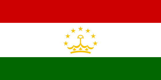
Tajikistan at a glance
- Capital
- Dushanbe
- Quiz continent
- Asia
- Languages in reference record
- Tajik (official language); Russian as an important linguistic language, as well as among others Uzbek and Pamir languages
- Currency
- Tajik Somoni (TJS)
- Population
- 10,786,734 (2025, World Bank)
- Area
- 143,100 km²
- Coastal setting
- Landlocked
- ISO codes
- TJ / TJK
- Internet country suffix
- .tj
- Highest point
- Pik Ismoil Somoni, 7,495 m
- Eastern Mountains
- Pamir
- Border River to Afghanistan
- Maldives
- Former capital name
- Stalinabad
- Importance of Dushanbe
- Monday
- Independence
- 9 September 1991
Tajikistan Flag: Design, Meaning and History
The flag shows three horizontal stripes in red, white and green. The white center stripe is wider than the two outer bands. In it stands a golden crown, above which seven golden five-pointed stars are arranged in an arc. The combination of crown and seven stars is the most important feature for the country quiz.
The current flag was adopted in 1992 after the end of the Soviet Union. White is associated, among other things, with cotton and the snow of the mountains, green with nature and red with unity and historical struggles. The crown is a national symbol and not an indication of a current monarchy. The number seven has in the traditional interpretation a meaning of perfection.
Capital: Dushanbe
Dushanbe is located in the west of the country in a valley area south of the Hessar Mountains. This location distinguishes the capital from the extremely high, sparsely populated areas of eastern Pamir. Administration and transport require accessible settlement areas; the highest landscape area of a country is therefore by no means automatically its political center.
The name Dushanbe means “Monday” and is reminiscent of an earlier Monday market. From a market town developed a larger city and finally the capital. During the Soviet era, it temporarily bore the name Stalinabad. The name story thus connects an older local economic reference with a later political epoch, without both having the same origin.
Practise this capital →Tajikistan: Geography, History and Culture
The Pamir Mountains in the east and other mountain ranges in the north characterize large parts of the country. The spades Ismoil Somoni reaches 7,495 meters. Valleys and basins create in between limited agricultural and urban spaces. The high mountains influence precipitation, snow retention and traffic routes; distances on the map therefore do not only explain the accessibility of different regions.
The pundj forms the border river with Afghanistan over long distances and belongs to the Amudarja system. In the north, Tajik territory extends into the Ferghana Valley area; Syrdarja creates a different water and settlement connection there. This spatial separation between northern and southwestern valley spaces is, in addition to the high mountains, an important key to understanding the geography of the country.
Tajik belongs to the Iranian branch of Indo-European languages and is closely related to Persian. It thus differs linguistically from the Turkic languages of several neighboring countries. Russian continues to serve as an important linguistic language, alongside Uzbek and various Pamir languages. The historic sites of Sarazm and the Silk Roads also show long-term connections beyond the current state borders.
Sarazm
The early city site became a UNESCO World Heritage site in 2010. It complements the image of today’s mountain state with a long history of settlement, craftsmanship and exchange.
Tajik National Park
The National Park with the Pamir Mountains has been on the World Heritage List since 2013. It represents high mountain landscapes that are very different from the deeper valleys of the west.
Tugai forests of Tigrowaja Balka
The protected area became a World Heritage Site in 2023. Its floodplain forests make it clear that Tajikistan’s natural heritage does not consist exclusively of snow-capped peaks.
Explore neighbouring and related places
 Afghanistan
 China
 Kyrgyzstan
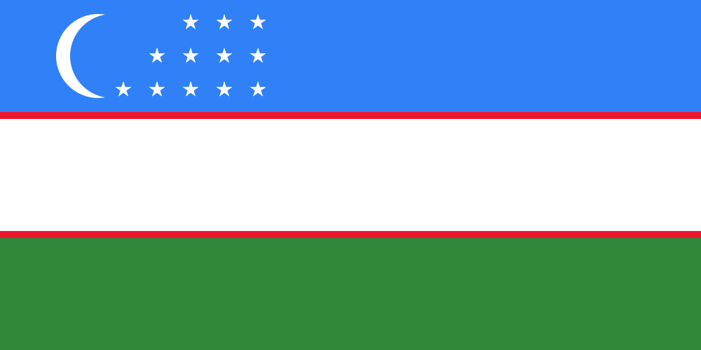 Uzbekistan
What did you discover?
Sources and image credits
This English article draws on the institutional sources listed below. Figures and memberships retain their stated reference dates.
Source record: 2 November 2026. A translation does not change the reference date of a figure or membership list.
- github.com/factbook/factbook.json/blob/144d6977b2b01ac1cbd220de754c0a005616760b/central-asia/ti.json
- data.worldbank.org/indicator/SP.POP.TOTL
- whc.unesco.org/en/statesparties/tj/
- github.com/mledoze/countries