Greece Flag, Capital and Country Facts
Greece connects the southern Balkan Peninsula with numerous islands in the Aegean and Ionian Seas. Athens is the capital and an important place of ancient history, but mountains, coasts and island groups shape the country just as strongly. The blue-and-white flag links a cross with nine horizontal stripes and is one of the most famous flags in the Mediterranean.
Test your knowledge →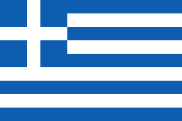
Greece at a glance
- Capital
- Athens
- Quiz continent
- Europe
- Languages in reference record
- Greek
- Currency
- Euro (EUR)
- Population
- 10,413,962 (2025, World Bank)
- Area
- 131,990 km²
- Coastal setting
- Not landlocked
- ISO codes
- GR / GRC
- Internet country suffix
- .gr
- Highest summit
- Mytikas on Olympus, around 2,917 m
- National holiday
- 25 March
- Port of Greater Athens
- Piraeus
- Western maritime area
- Ionian Sea
- Eastern maritime area
- Aegean
- Large island
- Crete
Greece Flag: Design, Meaning and History
Nine horizontal stripes of equal width alternate between blue and white; there is blue at the top and bottom. In the upper left corner stands a white cross on a blue square. The combination of stripe and cross field distinguishes Greece's flag from the Nordic cross flags, where the cross runs over the entire area.
The cross refers to the Orthodox Christian tradition. There are common explanations for the nine stripes and the two colors, but the Factbook archive does not mention a defined universal meaning. The exact blue shade was also reproduced differently historically. A legend about nine syllables should therefore be treated as an interpretation and not as a safe design rule.
Capital: Athens
Athens is located in Attica in the southeast of mainland Greece. The city is the political center of the modern state and at the same time an important historical place of remembrance. Acropolis and today's big city belong together spatially, but are temporally very different layers of the same capital.
The port of Piraeus connects the greater Athens area with the islands and international maritime traffic. This connection explains why a mainland capital can be central to a highly insular country. The traditional connection of the city name with the goddess Athena belongs to the ancient tradition; the exact linguistic history is thus not conclusively clarified.
Practise this capital →Greece: Geography, History and Culture
Greece, despite its maritime appearance, is extremely mountainous. With its highest peak, Olympus reaches Mytikas around 2,917 metres. Coasts, peninsulas and islands strongly divide the space. A short crow does not therefore have to correspond to a short land connection, and ferry connections are of particular importance for the accessibility of many places.
The island groups are not interchangeable with each other. Ionian islands lie west of the mainland, the Aegean, however, east of it; Crete forms a large southern island space. The Mediterranean climate with hot, dry summers meets different conditions depending on the altitude and region. In mountainous areas, snow and cool winters are also part of the landscape.
Ancient city-states, Roman and Byzantine history, Ottoman rule and the modern struggle for independence left behind various historical layers. The national holiday on March 25 commemorates 1821. Therefore, today’s Greece cannot be explained solely with classical antiquity or exclusively with its islands. Its World Heritage sites include archaeological sites as well as medieval and modern cultural landscapes.
Acropolis
The Acropolis of Athens is a UNESCO World Heritage Site and a striking reference point of the capital. It embodies a part of classical antiquity. Its location in the middle of today’s metropolitan area shows particularly clearly how historical monuments and modern urban development coexist.
Olymp
Olympus is the highest mountain in Greece and in ancient mythology the seat of the gods. Mythological significance and geographic height are different statements. Both explain, however, why the mountain has such a strong position in the image of the country.
Mainland and island world
Greece's territory includes large continental areas and numerous islands. This distribution characterizes transport and regional connections. The blue-and-white flag is the same everywhere, although the landscapes range from forested mountains to arid island coastlines.
Explore neighbouring and related places
 Albania
 Bulgaria
 Türkiye
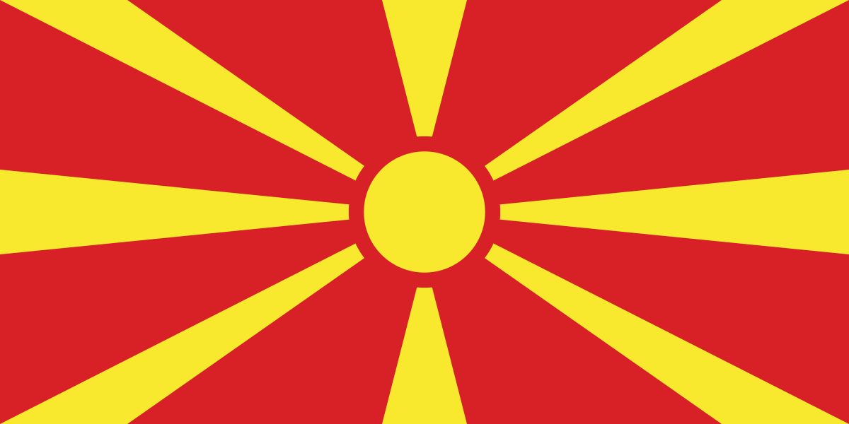 North Macedonia
What did you discover?
Sources and image credits
This English article draws on the institutional sources listed below. Figures and memberships retain their stated reference dates.
Source record: 2 November 2026. A translation does not change the reference date of a figure or membership list.
- github.com/factbook/factbook.json/blob/144d6977b2b01ac1cbd220de754c0a005616760b/europe/gr.json
- data.worldbank.org/indicator/SP.POP.TOTL
- whc.unesco.org/en/statesparties/gr
- github.com/mledoze/countries