Madrid: City Flag, History and Identity
Madrid is located inside the Iberian Peninsula and combines royal residence history, Spanish state institutions and large public green spaces. The Manzanares connects the city with the Sierra de Guadarrama. If you only look at Madrid over its palaces, you will miss a second thread: water, garden planning and the redesign of the river banks.
Test your knowledge →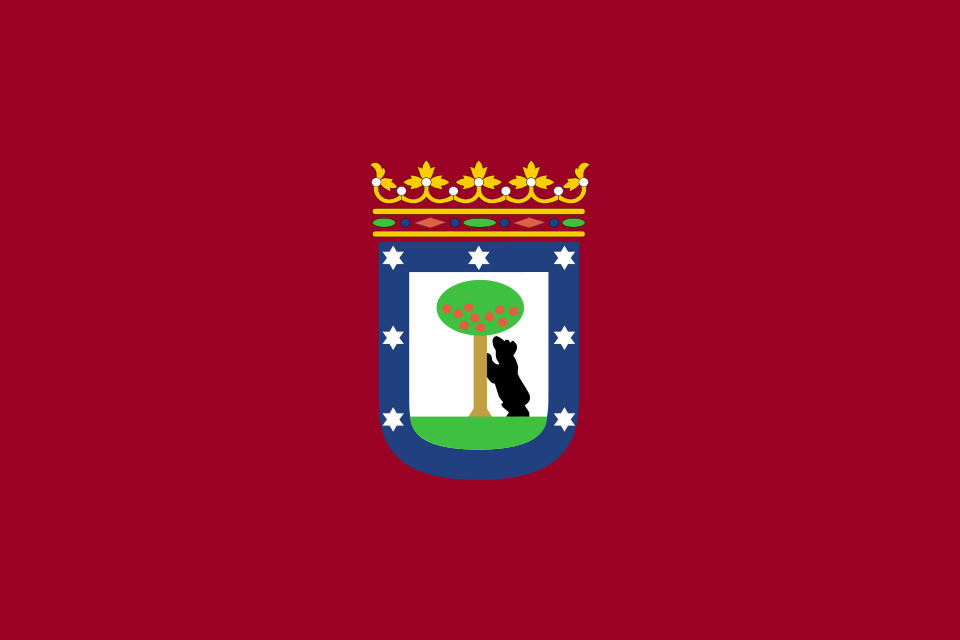
Madrid at a glance
- Name
- Madrid
- Country
- Spain
- Profile type
- City
- Urban river
- Manzanares
- Manzanares spring mountains
- Sierra de Guadarrama
- The next incoming river
- Jarama
- Previous Place Names
- Mayrite
- Received early attachment
- Cuesta de la Vega
- World Heritage Site since
- 2021: Paseo del Prado and Buen Retiro
- Parking area Retiro
- 125 hectares according to the urban tourism portal
- Riverside project
- Madrid Río
The Flag of Madrid
The city flag shown here bears a crowned coat of arms on a dark red, almost karmesin-colored background. In the sign you can see a raised bear on a tree and a blue bezel with stars. The large solid color background highlights the relatively small coat of arms; there is no additional strip division.
The administrative level shall be decisive for the allocation. The flag of the city of Madrid differs from the red flag of the autonomous community of Madrid, whose main motif is seven stars. The bear motif refers to the urban coat of arms. Further stories about tree and animal are not given here as a secured interpretation of origin.
Madrid: Location and Territorial Role
Madrid is the capital of Spain and also the capital of the autonomous community of the same name. However, the municipality is only a part of this larger region. Its historical core lies in the central plateau of the Iberian Peninsula. The Manzanares flows through the urban area and belongs to the river system of the Tajo.
The historic city can be understood along several focal points. To the west, the Royal Palace and gardens characterize the transition to the river. To the east, Paseo del Prado and Retiro form a large cultural and landscape space. In between are the grown streets of the center, whose layout is less regular than the later expansion districts.
Landscape, History and Culture
The Manzanares springs in the Sierra de Guadarrama and leads to the Jarama after his way through Madrid. It connects mountainous landscape, pastures, urban shores and more open areas in the south. The city is therefore not located on the sea, but has a landscape corridor that significantly influences its development and today's open space planning.
The written tangible history of Madrid dates back to an Islamic fortress in the ninth century. Remains of the old fortification are preserved on the Cuesta de la Vega. The later farmhouse and Bourbon building programs fundamentally changed the cityscape: fountains, gardens, monumental street spaces and the new royal palace made political power visible in urban space.
The award of Paseo del Prado and Buen Retiro as a UNESCO World Heritage Site in 2021 honors a landscape of art and science. This is more than a list of individual museum buildings. Public walking paths and garden spaces are part of the context. The recent design of the Madrid Río river also shows how much freedom contributes to the perception of the capital.
Retiros
According to the municipal tourism portal, the Retiro covers 125 hectares. The park includes various garden areas, a large pond and the Palacio de Cristal and the Palacio de Velázquez. This mix makes it a place where recreation, landscaping and culture are close together.
Madrid Río
The green areas of Madrid Río were created in connection with the undertunnelling of the M-30 motorway, allowing shores to be perceived more as a coherent public space. Historical bridges and the river landscape form a different access to the city here than the large squares of the center.
Campo del Moro
Below the Royal Palace, the Campo del Moro mediates between representative architecture and moving garden landscape. Axes of sight make the palace appear above the site. In addition to formal design, tree groups and small historical garden buildings belong to the ensemble, which makes the location of the palace above the Manzanares particularly vivid.
Explore this country and nearby profiles
 Spain
 Barcelona
 Catalonia
 Andalusia
What did you discover?
Take this flag into the quiz
Sources and image credits
This English article draws on the institutional sources listed below. Figures and memberships retain their stated reference dates.
Source record: 2 November 2026. A translation does not change the reference date of a figure or membership list.
- esmadrid.com/en/history-madrid
- esmadrid.com/informacion-turistica/parque-del-retiro
- esmadrid.com/jardines-manzanares
- commons.wikimedia.org/wiki/File%3ABandera_de_la_ciudad_de_Madrid.svg