Zimbabwe Flag, Capital and Country Facts
Zimbabwe is a landlocked country in southern Africa between Zambezi and Limpopo. Harare is the capital in the northeastern highlands. The ruins of Great Zimbabwe gave the state its name; the Victoria Falls connect it with neighboring Zambia. Highlands, eastern mountains and large river valleys form different landscapes within the same national boundaries.
Test your knowledge →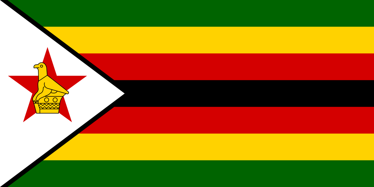
Zimbabwe at a glance
- Capital
- Harare
- Quiz continent
- Africa
- Languages in reference record
- 16 recognized official languages, including Shona, Ndebele, English and Sign Language
- Currency
- Zimbabwe Gold / ZiG (ZWG); in addition, US dollars in the multi-currency system
- Population
- 16,950,795 (2025, World Bank)
- Area
- 390,757 km²
- Coastal setting
- Landlocked
- ISO codes
- ZW / ZWE
- Internet country suffix
- .zw
- Highest mountain
- Nyangani, 2,592 m according to archives
- Independence
- 18 April 1980
- Former capital name
- Salisbury’
- Northern Border River
- Zambezi
- Southern boundary river
- Limpopo’
- Named ruins
- Great Zimbabwe
Zimbabwe Flag: Design, Meaning and History
Seven horizontal stripes of equal height follow one another in green, yellow, red, black, red, yellow and green. On the mast stands a white, black bordered triangle. Therein lies a red star and the golden Zimbabwean bird. The black middle stripe and the mirrored color sequence help to capture the complex pattern clearly.
Green is associated with agriculture, yellow with mineral resources, red with the struggle for independence and black with the population. White stands for peace. The bird refers to stone bird figures from Great Zimbabwe and connects the flag with the older history of the country. It is thus more than a general animal motif without reference to location.
Capital: Harare
Harare is located on an elevated area in the northeast. The capital was called Salisbury during the colonial period and was named Harare in 1982. Both terms in historical sources mean the same city location, but belong to different political epochs. For the quiz, Harare is the current and authoritative answer.
The altitude distinguishes Harare from the warmer deeper river valleys. So Zimbabwe's capital is not directly on the Victoria Falls or on the Zambezi. The most famous sights and political functions are spread over different parts of the country; a map with Harare, Great Zimbabwe and the Falls shows this spatial separation particularly clearly.
Practise this capital →Zimbabwe: Geography, History and Culture
Large parts of the country form a high plateau. In the east, the mountains rise higher; the Nyangani reaches 2,592 meters according to the Factbook archive. The Zambezi runs in the north, the Limpopo in the south. The differences in altitude influence temperatures and vegetation, which is why the blanket designation tropical alone does not sufficiently describe the local climate.
Great Zimbabwe is a UNESCO World Heritage site and preserves important stone buildings of a former African domination and trading company. The walls were built without mortar. The place is neither a European colonial foundation nor the current capital. Its historical significance extends into another epoch and explains the current name of the country as well as the bird motif of the flag.
The Victoria Falls form a joint UNESCO natural heritage site with Zambia. The also common name Mosi-oa-Tunya is usually translated as thunderous smoke. Other natural and cultural sites are Mana Pools and the Matobo Mountains. The linguistic diversity comprises 16 recognized official languages; Shona and Ndebele are important everyday languages, English also performs numerous functions.
Great Zimbabwe
The large stone walls are an independent testimony to the history of African construction and rule. The country name and the state sign pick up this place. This combines name, flag and archaeological heritage in a particularly concrete way that helps with learning more than general color explanations.
Victoria Falls with Zambia
The Zambezi is a cross-border natural site here. Anyone who attributes cases to only one country overlooks the common geographical location. Both states have access to the same river and waterfall system, whose ecological connections extend beyond the political border.
Highlands and valleys
The capital and large parts of the settlement are located on higher surfaces. Deeper river valleys have other climatic conditions. High altitude is therefore an important key to the understanding of the country and complements the classification of Zimbabwe according to its location in southern Africa.
Explore neighbouring and related places
 Botswana
 Mozambique
 South Africa
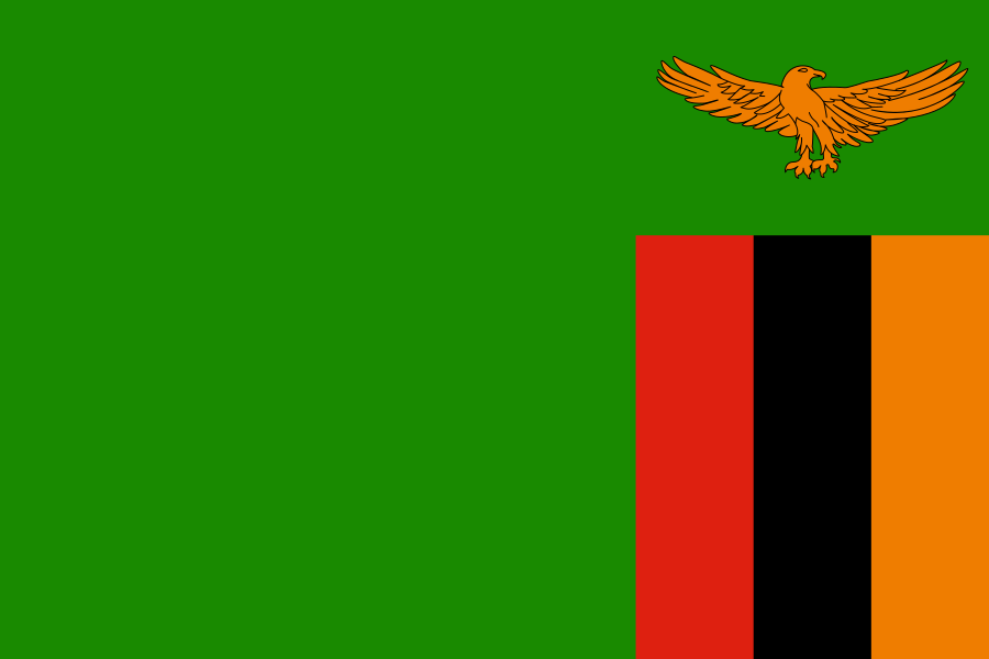 Zambia
What did you discover?
Sources and image credits
This English article draws on the institutional sources listed below. Figures and memberships retain their stated reference dates.
Source record: 2 November 2026. A translation does not change the reference date of a figure or membership list.
- github.com/factbook/factbook.json/blob/144d6977b2b01ac1cbd220de754c0a005616760b/africa/zi.json
- data.worldbank.org/indicator/SP.POP.TOTL
- whc.unesco.org/en/statesparties/zw/
- rbz.co.zw/documents/press/2024/July/PRESS_STATEMENT_ON_ZiG_CURRENCY_CODE.pdf
- rbz.co.zw/
- github.com/mledoze/countries