Venezuela Flag, Capital and Country Facts
Venezuela is located on the northern coast of South America between the Caribbean, Andes, Llanos and the highlands of Guayana. Caracas is the capital. The yellow-blue-red flag belongs to the historical family of Greater Colombia colors, but shows equally high stripes and eight stars. Extraordinary table mountains and waterfalls complement the image of the country, which is often mainly associated with oil.
Test your knowledge →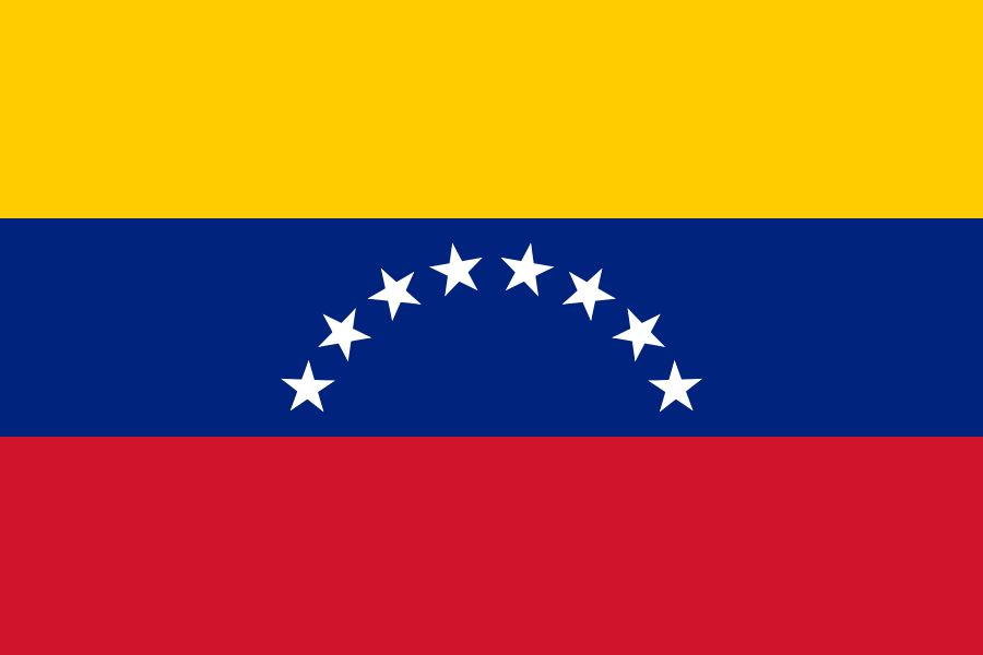
Venezuela at a glance
- Capital
- Caracas
- Quiz continent
- South America
- Languages in reference record
- Spanish (official language); indigenous languages for the respective communities also officially
- Currency
- Bolívar (VES)
- Population
- 28,516,896 (2025, World Bank)
- Area
- 916,445 km²
- Coastal setting
- Not landlocked
- ISO codes
- VE / VEN
- Internet country suffix
- .ve
- Highest summit
- Pico Bolívar, 4,978 m according to Factbook Archive
- Large river
- Orinoco
- Large Levels
- Llanos
- Table mountains
- Tepuis
- Waterfall
- Salto Ángel, 979 m drop height according to archives
- National holiday
- 5 July, reference to 1811
Venezuela Flag: Design, Meaning and History
Three equally high horizontal stripes are in yellow, blue and red. In the blue middle stripe, eight white five-pointed stars form an arc. The simple flag version shown here in the quiz has no state coat of arms. In addition, there is a state version with coats of arms in the yellow stripe; these variants should not be confused.
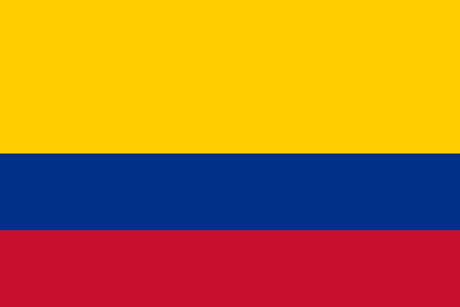
The colors go back to the common history of Greater Colombia. Unlike Colombia and Ecuador, yellow is not double high here. In 2006, an eighth star was added, representing the historic province of Guayana. Older images with seven stars therefore do not describe the motif used today in the quiz.
Capital: Caracas
Caracas is located in the north in a valley of the coastal mountains. A mountain range separates the city from the Caribbean Sea. The capital is therefore geographically different from a port town located directly on the waterline, although it is close to the coast.
The name goes back to an indigenous population of the region. Caracas is a political and economic centre and has with the university city a UNESCO World Heritage site of modern times. Thus, the city’s history includes not only colonial foundation and state administration, but also an internationally acclaimed architecture complex of the 20th century.
Practise this capital →Venezuela: Geography, History and Culture
To the northwest are Andes and the lowlands around Lake Maracaibo. The Llanos form large plains in the Orinoco catchment area. In the southeast rises the highlands of Guayana with its striking table mountains, the Tepuis. The landscapes vary greatly in altitude and water balance. Venezuela is therefore neither exclusively Caribbean coast nor continuously tropical lowland forest.
The Orinoco is a central river axis and reaches the sea in a large delta. The Tepuis have steep walls and often isolated peaks on which special habitats were created. The Factbook archive cites the Salto Ángel as the highest waterfall with 979 meters. Its drop height is not the same as the sea level of the source mountain; both are different geographical sizes.
Venezuela emerged in 1830 from the disintegration of Greater Colombia. Spanish is the central official language, indigenous languages also have official significance for their respective communities. Oil strongly influenced economic development. However, current information on inflation, migration or political power must come from dated new sources; the factbook archive status provided is not an unchanged description of the present.
Canaima
The Canaima National Park became a UNESCO natural heritage site in 1994. The table mountain landscapes of the Guiana Highlands are among its characteristic features. The entry makes visible the geological peculiarity of the southeast and complements the more well-known oil and coastal regions.
University city of Caracas
The Ciudad Universitaria de Caracas has been on the World Heritage List since 2000. It pays tribute to the architecture and design of modernity. The entry shows that World Heritage does not only include ancient ruins or colonial old towns.
Coro and its port
Coro and its port were registered as a World Heritage Site in 1993. The site documents a different historical building and settlement landscape than Caracas. Venezuela’s cultural history is thus distributed among different regional centers and time layers.
Explore neighbouring and related places
 Brazil
 Colombia
 Guyana
What did you discover?
Sources and image credits
This English article draws on the institutional sources listed below. Figures and memberships retain their stated reference dates.
Source record: 2 November 2026. A translation does not change the reference date of a figure or membership list.
- github.com/factbook/factbook.json/blob/144d6977b2b01ac1cbd220de754c0a005616760b/south-america/ve.json
- data.worldbank.org/indicator/SP.POP.TOTL
- whc.unesco.org/en/statesparties/ve
- mincultura.gob.ve/eventos/dia-de-la-bandera-nacional/
- github.com/mledoze/countries