Netherlands Flag, Capital and Country Facts
The Netherlands is located on the North Sea and is closely connected to the Rhine, the Meuse and the handling of water. Amsterdam is the capital, The Hague the seat of government. The red-white-blue flag belongs to the older European tricolors; in addition to the European part of the country, the state also includes Caribbean islands, which must be taken into account in geographical records.
Test your knowledge →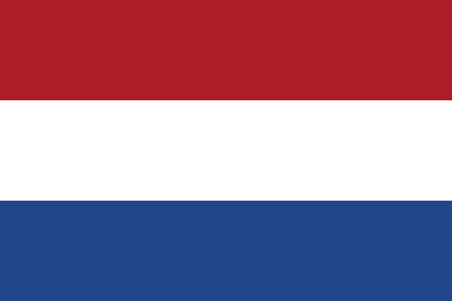
Netherlands at a glance
- Capital
- Amsterdam
- Quiz continent
- Europe
- Languages in reference record
- Dutch; Frisian in Friesland, other regionally recognized languages
- Currency
- Euro (EUR) in the European part of the country; US dollars in Bonaire, Sint Eustatius and Saba
- Population
- 18,087,633 (2025, World Bank)
- Area
- 41,850 km²
- Coastal setting
- Not landlocked
- ISO codes
- NL / NLD
- Internet country suffix
- .nl
- Headquarters
- The Hague
- Highest point overall
- Mount Scenery on Saba, 862 m
- Highest European point
- Vaalserberg, about 322 m
- Large rivers
- Rhine and Maas
- Historical polder
- Beemster
- Hydraulic engineering World Heritage Site
- Kinderdijk-Elshout mill network
Netherlands Flag: Design, Meaning and History
Amsterdam is the capital; the government and parliament are based in The Hague.
Three equally high horizontal stripes are in red, white and dark blue. A coat of arms or star is missing. Compared to Luxembourg, the darker blue shade is particularly helpful; even the usual official proportions differ. The order red-white-blue remains the most reliable basic feature of the Dutch flag.
The colors evolved from older orange-white-blue banners of the Dutch independence movement. Red prevailed instead of orange. Orange nevertheless remains an important national color, for example in sports and royal celebrations. An orange dressed team therefore does not use another state banner, but resorts to a related historical color symbolism.
Capital: Amsterdam
Amsterdam is the capital of the Netherlands and is located on the IJ and the river system of the Amstel. The name refers to a dam on the Amstel. The 17th century canal belt became a UNESCO World Heritage site in 2010. Water is also part of urban planning, transport routes and the historical development of an international commercial centre.
The Hague, on the other hand, is the seat of government and the location of parliament and central ministries. This separation is indispensable for capital issues: Amsterdam remains the right quiz answer, even if a lot of political news comes from The Hague. The Netherlands thus offers a vivid example of the fact that constitutional capital and actual seat of government denote different functions.
Practise this capital →Netherlands: Geography, History and Culture
Large parts of the European country are flat; polders, dikes and drainage facilities characterize the landscape. The Rhine and Maas connect the national territory with large European catchment areas. So the water does not only come from the sea or from local rain. Flood protection and drainage must take into account rivers, coasts and managed lowlands at the same time.
The highest point of the European part of the country is the Vaalserberg with about 322 meters. For the entire Netherlands, however, the record is on Saba: Mount Scenery reaches 862 meters. Bonaire, Sint Eustatius and Saba belong to the state as special municipalities. The wider kingdom also includes Aruba, Curaçao and Sint Maarten as separate countries; these levels should be kept apart.
Dutch is the central official language, Frisian has its own official status in Friesland. The term Holland means strictly speaking only part of the Netherlands and is not congruent with the entire state. Historical port cities, agricultural areas and modern industrial areas form different regional focal points. The known water landscape is therefore an important connection, but not a complete description of each part of the country.
Kinderdijk
The mill network of Kinderdijk-Elshout has been on the World Heritage List since 1997. It illustrates the technical and organizational history of water regulation.
Beemster polder
The Beemster became a World Heritage Site in 1999. Its planned cultural landscape shows how land reclamation and systematic land distribution were linked.
Wadden Sea
The cross-border natural heritage also includes the Dutch coast. It complements the human-drained polders with a dynamic tidal space whose natural changes remain essential.
Explore neighbouring and related places
 Belgium
 Germany
Cities and regions in this country
 Amsterdam
 Rotterdam
 The Hague
What did you discover?
Sources and image credits
This English article draws on the institutional sources listed below. Figures and memberships retain their stated reference dates.
Source record: 2 November 2026. A translation does not change the reference date of a figure or membership list.
- github.com/factbook/factbook.json/blob/144d6977b2b01ac1cbd220de754c0a005616760b/europe/nl.json
- data.worldbank.org/indicator/SP.POP.TOTL
- whc.unesco.org/en/statesparties/nl/
- github.com/mledoze/countries