Uruguay Flag, Capital and Country Facts
Uruguay lies between Brazil, Argentina, the Río de la Plata and the Atlantic Ocean. Gentle hills and grasslands characterize the state more than high mountains. Montevideo is the capital at the wide estuary. The flag connects nine blue-and-white stripes with the Maisonne and thus commemorates early administrative division as well as the regional history of independence.
Test your knowledge →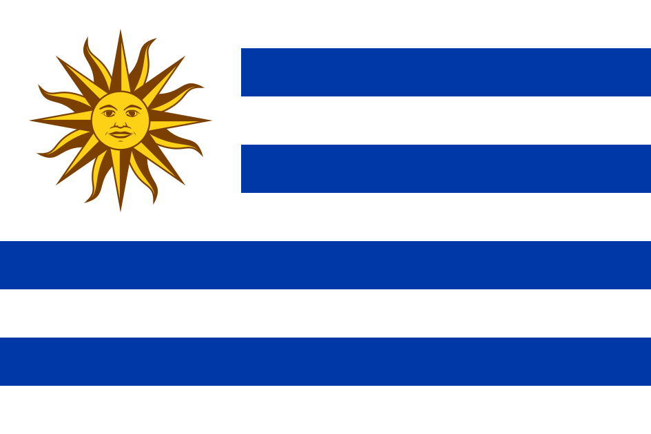
Uruguay at a glance
- Capital
- Montevideo
- Quiz continent
- South America
- Languages in reference record
- Spanish, especially rioplatensic forms; in the border area also Portuguese-influenced varieties
- Currency
- Uruguayan peso (UYU)
- Population
- 3,384,688 (2025, World Bank)
- Area
- 181,034 km²
- Coastal setting
- Not landlocked
- ISO codes
- UY / URY
- Internet country suffix
- .uy
- Highest point
- Cerro Catedral, 514 m
- Western Border River
- Uruguay
- Great mouth
- River de la Plata
- Today's departments
- Nineteen
- Stripes as a historical reference
- Nine original departments
- Modern World Heritage Church
- Church of Atlántida
Uruguay Flag: Design, Meaning and History
Nine horizontal stripes alternate between white and blue; above and below is white. In the white upper mast field appears a golden sun with a human face. The sun's rays alternate between straight and wave-shaped forms. The white solar field interrupts the stripes and makes the flag easily recognizable even from a greater distance.
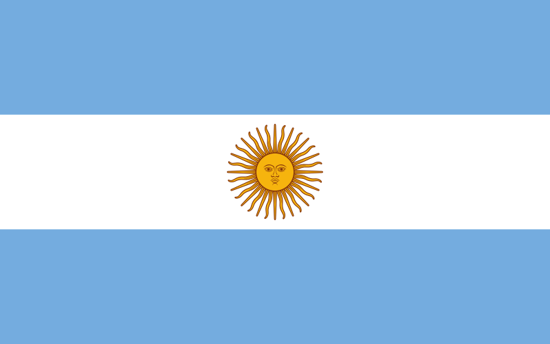
The nine stripes represent the original nine departments, not the current number of administrative units. The sun is called the Maisonne and connects the flag with the independence story of the Río-de-la-Plata space. Argentina uses a related sun motif, but has only three wide stripes. The number and arrangement of the belts therefore prevent frequent confusion.
Capital: Montevideo
Montevideo is located on the Río de la Plata, whose wide estuary mediates between the river and the sea. The capital is an important political, economic and cultural centre. Its port location connects the state with Argentina and the Atlantic Ocean. The city is therefore neither deep inland nor directly on a narrow ordinary river course.
The name Montevideo refers to a hill in various explanatory approaches; the exact derivation is controversial. Instead of giving a popular name interpretation as sure, the actual geography helps: The Cerro de Montevideo is a visible reference point of the bay. The coastal promenade Rambla belongs to the spatial relationship between city and water and shapes today's cityscape.
Practise this capital →Uruguay: Geography, History and Culture
Uruguay consists mainly of wavy plains and low hills. The Cerro Catedral reaches 514 meters according to the Factbook archive. High mountains are missing; grasslands and agricultural use characterize large spaces. However, the low altitude record does not explain all landscapes, because river valleys, wetlands and coastal sections create regional differences at significantly smaller altitudes.
The Uruguay River forms a large part of the western border with Argentina. Further south, the border area passes into the Río de la Plata, while the east coast is on the Atlantic Ocean. Brazil borders on the north and northeast. This situation explains linguistic and economic links with both large neighbouring states, without reducing Uruguay to a mere intermediate space.
Spanish is the predominant language; Portuguese-influenced language forms exist in the border area with Brazil. Historical agriculture and livestock farming are linked to export-oriented economic areas. The Fray Bentos World Heritage Site shows this interconnection in a particularly concrete way: an industrial landscape opens up the history of processing agricultural products for international markets. Other UNESCO sites concern historical urban development and modern engineering.
Colonia del Sacramento
The historic quarter became a World Heritage site in 1995. The city is reminiscent of the competing European influences and trade relations in the Río-de-la-Plata area.
Fray Bentos
The industrial landscape has been on the World Heritage List since 2015. It connects livestock farming, industrial processing and worldwide sales markets in a concrete historical location.
Church of Atlántida
Engineer Eladio Dieste’s plant became a World Heritage Site in 2021. The church extends the historical heritage with innovative construction of the 20th century and shows a different side than colonial old towns.
Explore neighbouring and related places
 Argentina
 Brazil
What did you discover?
Sources and image credits
This English article draws on the institutional sources listed below. Figures and memberships retain their stated reference dates.
Source record: 2 November 2026. A translation does not change the reference date of a figure or membership list.
- github.com/factbook/factbook.json/blob/144d6977b2b01ac1cbd220de754c0a005616760b/south-america/uy.json
- data.worldbank.org/indicator/SP.POP.TOTL
- whc.unesco.org/en/statesparties/uy/
- github.com/mledoze/countries