El Salvador Flag, Capital and Country Facts
El Salvador is located on the Pacific coast of Central America between Guatemala and Honduras. Volcanoes, highlands and lakes characterize the smallest mainland country in the region. San Salvador is the capital. The blue-white-blue flag is reminiscent of the former Central American Federation; however, a historical reference to the Caribbean does not mean that today's country has a Caribbean coastline.
Test your knowledge →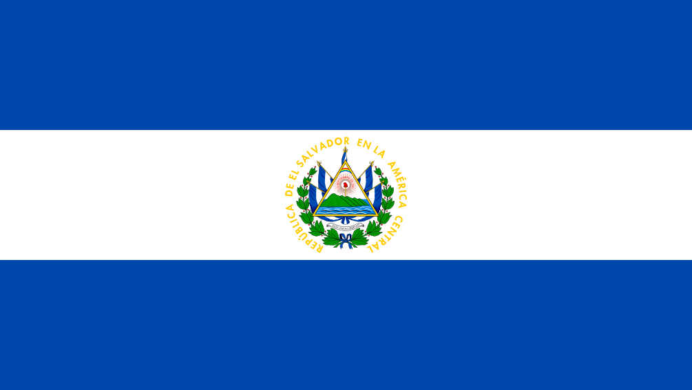
El Salvador at a glance
- Capital
- San Salvador
- Quiz continent
- North America
- Languages in reference record
- Spanish; Nawat is preserved by parts of the indigenous population
- Currency
- US dollar (USD)
- Population
- 6,365,503 (2025, World Bank)
- Area
- 21,041 km²
- Coastal setting
- Not landlocked
- ISO codes
- SV / SLV
- Internet country suffix
- .sv
- Highest point
- Cerro El Pital, 2,730 m
- Characteristic river
- Lempa
- Eastern Gulf
- Gulf of Fonseca
- Land neighbours
- Guatemala and Honduras
- World Heritage
- Joya de Cerén, since 1993
- Independence Day
- 15 September 1821
El Salvador Flag: Design, Meaning and History
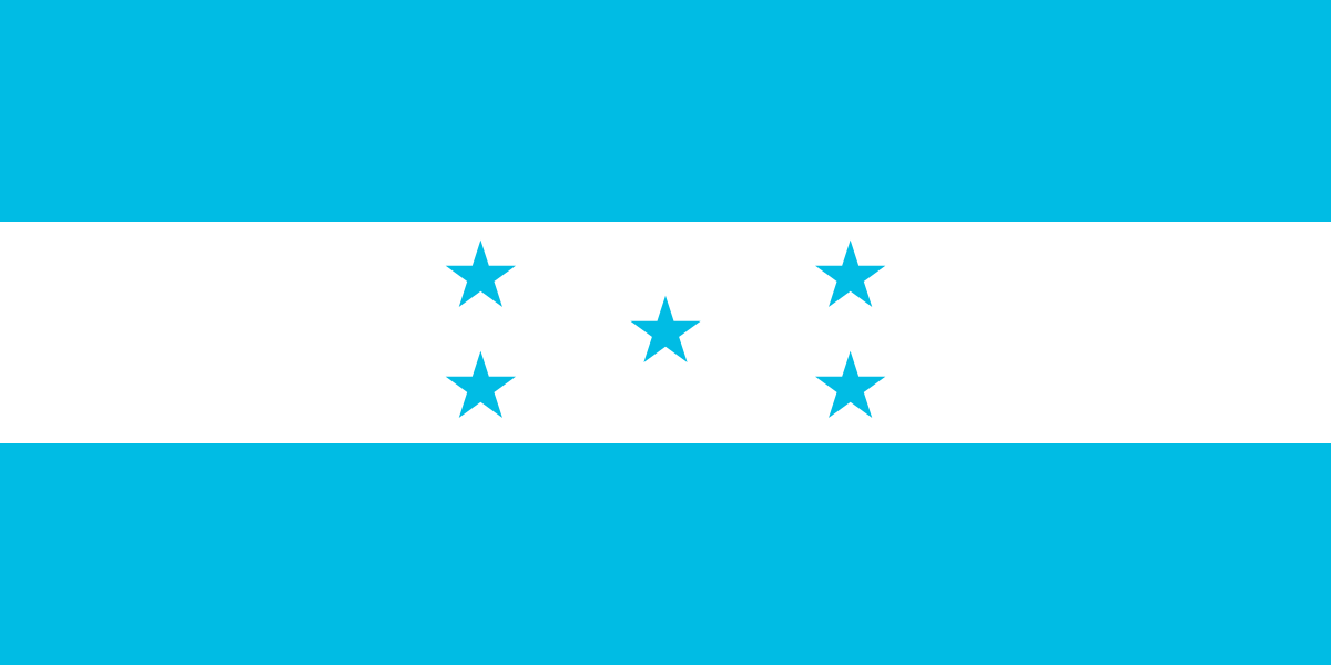
Three equally high horizontal stripes are in blue, white and blue. In the middle of the white field lies the state coat of arms with triangle, volcanoes and other symbols. A circulating inscription calls the Republic of Central America. In small representations, the central coat of arms is especially important, which distinguishes the flag of Honduras with its five blue stars.
The motif is based on the flag of the former Federal Republic of Central America. The blue stripes are connected to the two seas of the Central American Land Bridge. This is a historical-regional reference: El Salvador itself has only one Pacific coast. Nicaragua also uses blue-white-blue, but with a different coat of arms, so the details of the middle sign become crucial when comparing.
Capital: San Salvador
San Salvador is located inland in a volcanic basin. The capital is the political and economic center and forms the core of a larger metropolitan area. Their location makes it clear that the centre of a coastal state does not necessarily have to be directly on the sea. The nearby volcano is one of the striking natural reference points of the region.
The name San Salvador means “Holy Redeemer” and is in the context of Spanish colonial history. Historical urban development, earthquakes and reconstruction repeatedly shaped the space. For orientation, the comparison with Santa Ana in the west and San Miguel in the east is worthwhile: these cities form further regional centers, while the national capital functions are concentrated in San Salvador.
Practise this capital →El Salvador: Geography, History and Culture
A narrow coastal plain lies on the Pacific Ocean, followed by volcanoes, highlands and mountains. The Cerro El Pital on the border with Honduras reaches 2,730 meters according to the factbook archive and is the highest point. It is no proof that any high mountain in the country would be a volcano. Geological forms and altitude records should therefore be learned separately.
The Lempa is a formative river and connects several Central American spaces. Lakes and volcanic basins create further characteristic landscapes. The Gulf of Fonseca lies to the east and is shared with Honduras and Nicaragua. Although Nicaragua lies opposite there, El Salvador has its direct land borders only with Guatemala and Honduras; marine neighbourhood and land neighbourhood are not the same.
Spanish dominates, while Nawat as an indigenous language is preserved and passed on by parts of the population. The archaeological site Joya de Cerén provides insights into an earlier agricultural everyday life and complements the perception often focused on large Mayan temples. Modern economic connections extend far abroad via migration and trade. As an everyday means of payment, the US dollar is of central importance.
Joya de Cerén
The archaeological site has been on the World Heritage List since 1993. Volcanic deposits preserved traces of a settlement and thus enabled unusual insights into everyday and agricultural history.
Pacific coastal state
El Salvador has no access to the Caribbean Sea. The two blue stripes of the flag are explained by the common Central American symbolic tradition and not by two present-day coasts of their own.
Highest point on the border
Cerro El Pital is located in the border area with Honduras. The mountain location differs significantly from the warm coastal plains on the Pacific.
Explore neighbouring and related places
 Guatemala
 Honduras
What did you discover?
Sources and image credits
This English article draws on the institutional sources listed below. Figures and memberships retain their stated reference dates.
Source record: 2 November 2026. A translation does not change the reference date of a figure or membership list.
- github.com/factbook/factbook.json/blob/144d6977b2b01ac1cbd220de754c0a005616760b/central-america-n-caribbean/es.json
- data.worldbank.org/indicator/SP.POP.TOTL
- whc.unesco.org/en/statesparties/sv/
- github.com/mledoze/countries