Monaco Flag, Capital and Country Facts
Monaco is a very small city-state on the French Mediterranean coast. The Principality connects densely built quarters, harbour facilities and steep slopes in a confined space. Its flag consists only of red and white. It is precisely this simplicity that makes the comparison with Indonesia important: The colors coincide, the usual aspect ratios differ.
Test your knowledge →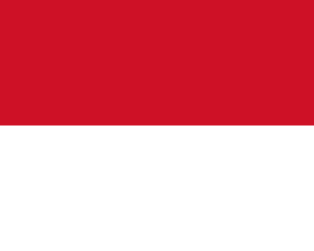
Monaco at a glance
- Capital
- Monaco
- Quiz continent
- Europe
- Languages in reference record
- French; also, among others, Monegasque and Italian
- Currency
- Euro (EUR)
- Population
- 38,341 (2025, World Bank)
- Area
- 2.02 km²
- Coastal setting
- Not landlocked
- ISO codes
- MC / MCO
- Internet country suffix
- .mc
- Form of the State
- Principality
- Single neighbour
- France
- Sea
- Mediterranean Sea
- Historical Quarter
- Monaco Villa
- Well-known district
- Monte Carlo
- Dynasty
- House of Grimaldi
Monaco Flag: Design, Meaning and History
Two equally high horizontal stripes form the flag: red above and white below. The national motif shown has no coat of arms and no inscription. A white-red flag, on the other hand, would be attributed to Poland. For Monaco and Indonesia, the proportion helps further: Monaco traditionally uses a shorter form relative to the height.
Red and white are the colors of the House of Grimaldi and possess a long heraldic tradition. Today's simple national flag can be distinguished from representative flags with the princely coat of arms. Especially with a Principality, this difference is important: Dynastic coats of arms, personal standards and the flag of the state are not automatically the same kind of symbol.
Capital: Monaco
Monaco is given as the capital because the sovereign state itself forms a closely connected city. Monaco-Ville denotes the historic district on the rock with the Princely Palace. Monte-Carlo, on the other hand, is another famous district. It is neither a separate state nor the capital of a country separated from the rest of Monaco.
The dense development explains why districts stand out particularly strongly on maps. The port, historic old town and newer quarters are very close to each other, but fulfil different functions. The name city-state is therefore more vivid here than the idea of a larger country with a single dominant capital and a sprawling rural hinterland.
Practise this capital →Monaco: Geography, History and Culture
Monaco borders on land exclusively with France and has a coastline on the Mediterranean Sea in the south. Steep slopes restrict the usable area. Land extraction from the sea is therefore part of the history of spatial development. Area indications can change as a result; for a permanent country portrait, the description of the coastal and slope location is more reliable than an undated apparently exact square kilometer number.
French is the official language. Monegasque belongs to the regional Ligurian linguistic environment and refers to the situation between French and Italian cultural areas. Today’s population is internationally shaped. The Principality has its own state institutions despite close links with France. Its small size must therefore not be confused with the status of an ordinary French neighbourhood.
The UNESCO country profile mentions the Alpes de la Méditerranée on the list of proposals, but does not include a registered World Heritage Site in Monaco. Well-known sights are therefore not only because of their celebrity World Heritage. Monaco’s international work to protect marine habitats also shows that the importance of a small coastal state can extend beyond its own narrow land area.
Monte-Carlo is a district
The well-known name refers to a part of Monaco. The capital remains Monaco; a second independent city or a second state does not arise from it.
Red over white
The order of the colors is important. Poland reverses them, while Indonesia uses the same color order with a different usual proportion.
A state on a slope
The steep coast limits arable space. Dense development and land reclamation are therefore geographically linked.
Explore neighbouring and related places
 France
What did you discover?
Sources and image credits
This English article draws on the institutional sources listed below. Figures and memberships retain their stated reference dates.
Source record: 2 November 2026. A translation does not change the reference date of a figure or membership list.
- github.com/factbook/factbook.json/blob/144d6977b2b01ac1cbd220de754c0a005616760b/europe/mn.json
- data.worldbank.org/indicator/SP.POP.TOTL
- whc.unesco.org/en/statesparties/mc
- github.com/mledoze/countries