Haiti Flag, Capital and Country Facts
Haiti occupies the western part of Hispaniola and shares the island with the Dominican Republic. The country combines mountainous landscapes with a history in which the struggle against enslavement and colonial rule is central. Port-au-Prince is located on a sea bay; the blue-red flag bears a white coat of arms in its center.
Test your knowledge →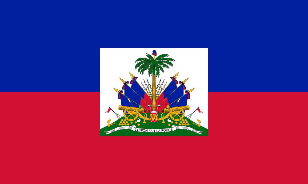
Haiti at a glance
- Capital
- Port-au-Prince
- Quiz continent
- North America
- Languages in reference record
- Haitian Creole and French (official languages)
- Currency
- Gourde (HTG)
- Population
- 11,906,095 (2025, World Bank)
- Area
- 27,750 km²
- Coastal setting
- Not landlocked
- ISO codes
- HT / HTI
- Internet country suffix
- .ht
- Island
- Hispaniola
- Neighboring country on the island
- Dominican Republic
- Highest mountain
- Pic la Selle, 2,674 m
- Independence
- 1 January 1804
- Capital Bay
- Gulf of Gonâve
- World Heritage
- National History Park, since 1982
Haiti Flag: Design, Meaning and History
Two equally high stripes are in blue over red. In the middle is a white rectangle with the coat of arms of the state. In it appear a palm tree, flags and cannons as well as a banner. The white rectangle is part of the coat of arms representation and not a third strip extending over the entire width.
The colors are historically associated with the French tricolor. The flag is related to the Haitian independence movement. The banner reads “L’Union fait la force”, meaning “unity makes strong”. For the quiz, blue over red and the central coat of arms are the most distinctive features, not every detail of the small drawing.
Capital: Port-au-Prince
Port-au-Prince is located on the Gulf of Gonâve in the western part of Hispaniola. The name means “Prince’s port”. The city is the political center of Haiti and bundles important economic tasks. Its coastal position is also in contrast to the numerous mountain landscapes in the rest of the country.
The capital was severely hit by the 2010 earthquake. This historic event shows that Haiti’s natural hazards do not arise solely from its Caribbean location and tropical cyclones. Tectonic risks are added. Current population or safety information about the city, on the other hand, requires its own time-related sources and cannot be derived from a historical country overview.
Practise this capital →Haiti: Geography, History and Culture
Haiti is predominantly mountainous; between the high altitudes lie plains and river valleys. The Pic la Selle reaches 2,674 meters. The coasts run on strongly structured peninsulas and bays. Although Haiti is located on an island, inland routes are therefore not short or easy everywhere. Relief and transport links must be considered together.
Haitian Creole and French are official languages. Creole is an independent language and must not be described as merely flawed French. It refers to the history of a society that emerged from colonial violence, African diaspora and the establishment of an independent state. Language is thus an important access beyond the often crisis-constricted representation of the country.
On January 1, 1804, Haiti declared its independence from France. It followed a revolution in which enslaved people fought for their freedom. UNESCO highlights the monuments of the National Historical Park as evidence of early independence. The Republic and its buildings therefore have an importance that extends far beyond the relatively small area of land.
Citadel and Sans Suoci
The National Historic Park with Citadel, Sans-Souci and Ramiers has been a World Heritage Site since 1982. The buildings are located in northern Haiti. UNESCO explicitly connects its importance with the beginning of independence and the struggle for freedom of formerly enslaved people.
One island, two states
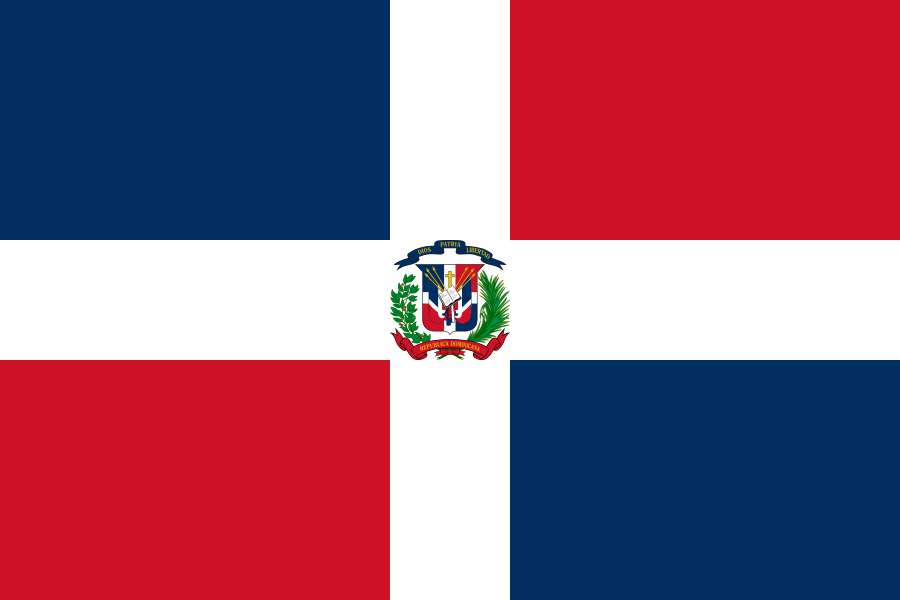
Haiti and the Dominican Republic share Hispaniola. This is a geographical commonality, not an equivalence of their political and linguistic history. For the country learning, therefore, both the common island and the different capitals and flags help.
Mountains in the Caribbean
With the Pic la Selle, Haiti has a peak well over 2,000 meters. This contradicts the simplified picture of exclusively flat tropical islands. The differences in altitude affect settlements, agriculture and paths between the different parts of the country.
Explore neighbouring and related places
 Dominican Republic
What did you discover?
Sources and image credits
This English article draws on the institutional sources listed below. Figures and memberships retain their stated reference dates.
Source record: 2 November 2026. A translation does not change the reference date of a figure or membership list.
- github.com/factbook/factbook.json/blob/144d6977b2b01ac1cbd220de754c0a005616760b/central-america-n-caribbean/ha.json
- data.worldbank.org/indicator/SP.POP.TOTL
- whc.unesco.org/en/statesparties/ht
- whc.unesco.org/en/list/180
- github.com/mledoze/countries